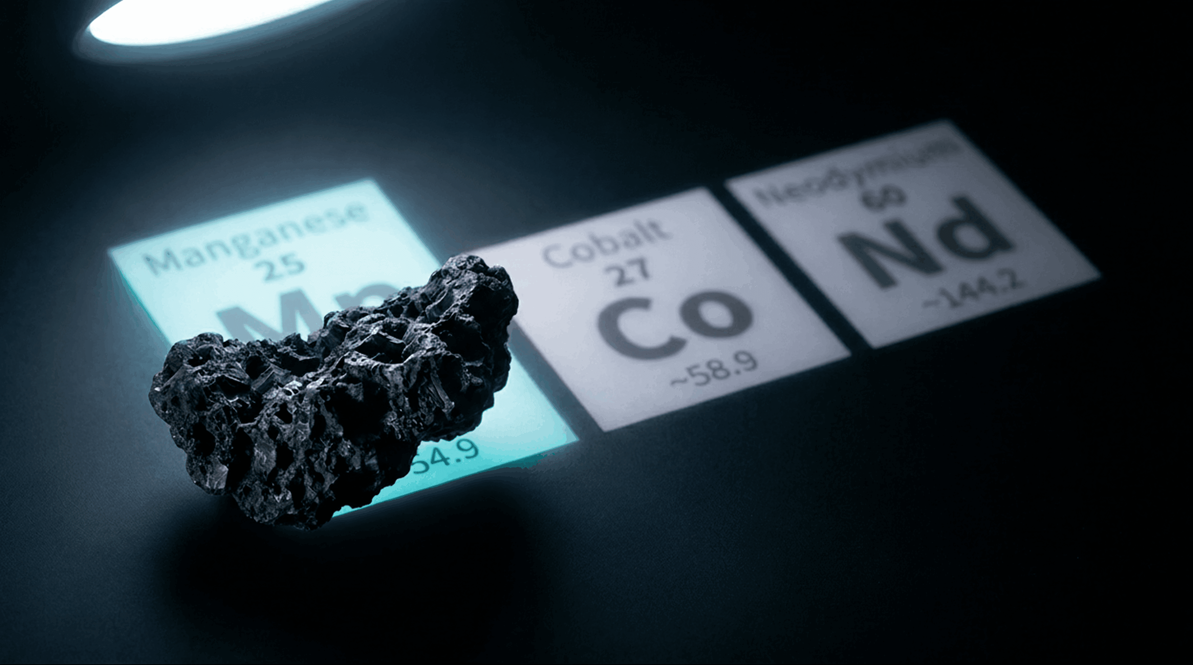
CONCEPT VISUALIZATION

Less Than 0.001% of the Deep Ocean Has Ever Been Observed.

That’s 3,823 km². The size of Rhode Island. We’re designing the fleet to change that.

The Problem

NASA Gets 541× More Funding Than Ocean Exploration

We pour billions into exploring other planets while ignoring the vast majority of our own. The deep ocean remains the largest unexplored frontier on Earth.

72.7%

Ocean floor unmapped

Seabed 2030, June 2025

541:1

NASA vs ocean exploration

$24.9B vs $46M, FY2024

$20T

Seafloor mineral deposits

Arthur D. Little, 2024

2/3+

Deep-sea life unknown

WoRMS + deep-sea DNA studies

The System

Submarine Mothership.
Tethered Rover Fleet.

A crewed submarine at 4,000m acts as a mobile base station, deploying expendable spherical rovers on short tethers with active buoyancy management.

100m
1000m
2000m
3000m
4000m
5000m
MOTHERSHIP — DEPTH: 4,000MAlpha — BioBeta — MineralGamma — ClimateSEA LEVEL

Click a rover to inspect

The Concept

From Surface to Seafloor

Move your light across the deep. Three stages, one mission.
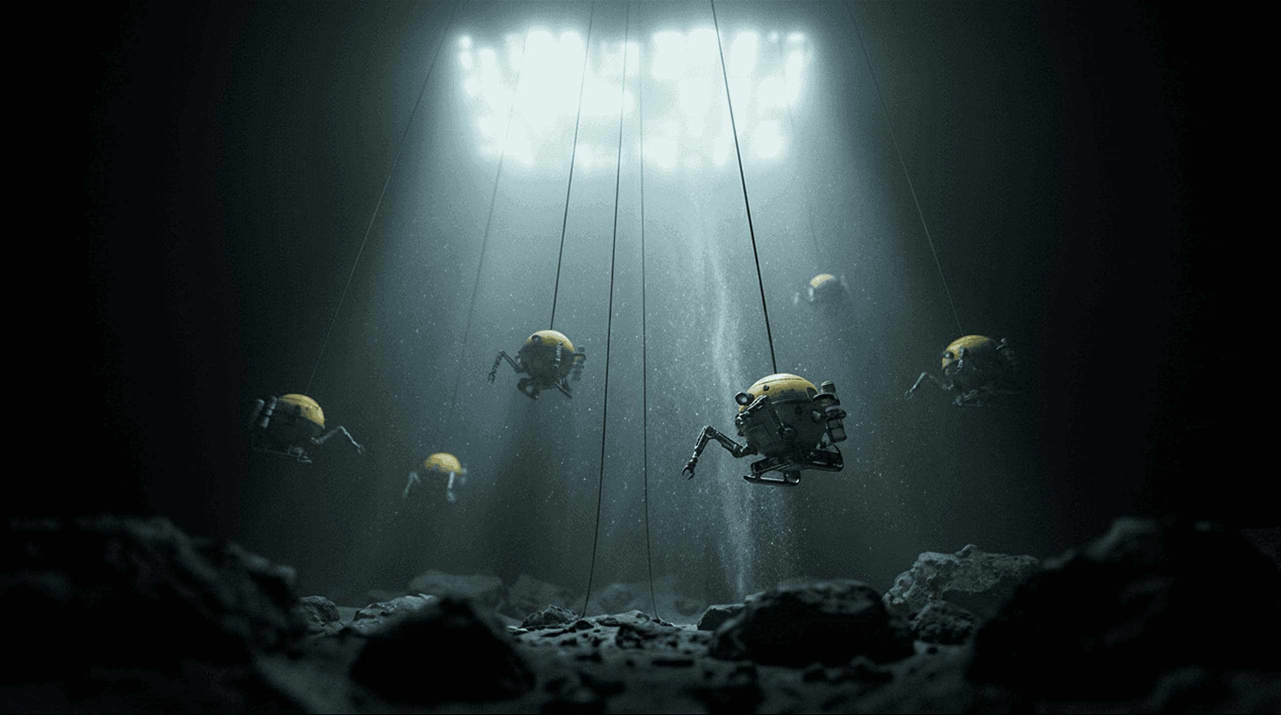
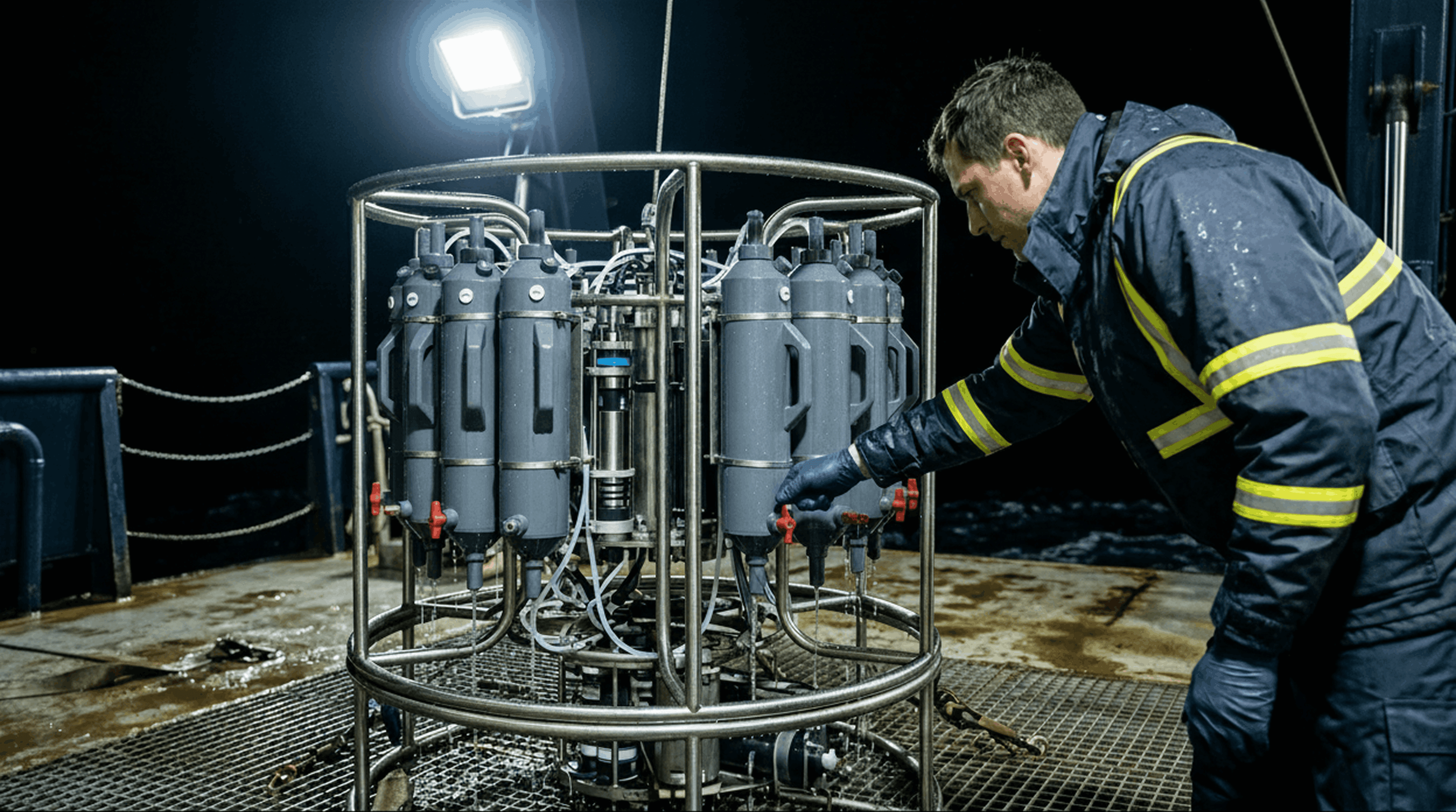
Deployment

Mothership holds position at 4,000m. Rovers deploy on tethers.
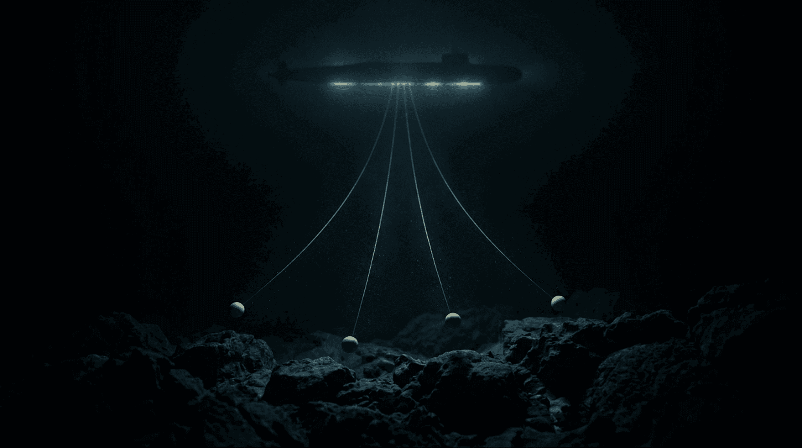
Descent

Buoyancy-managed rovers descend to operating depth. Arms deploy.
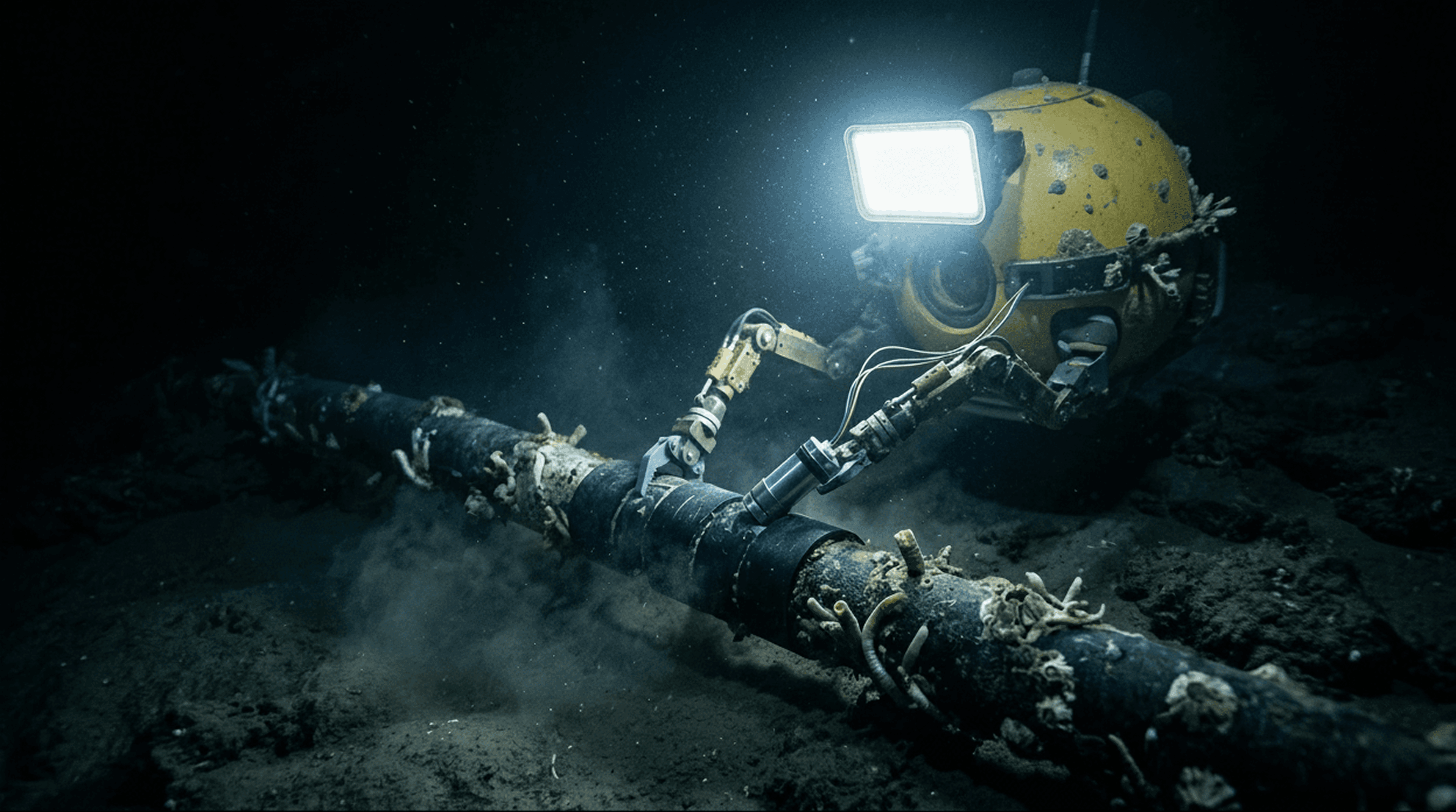
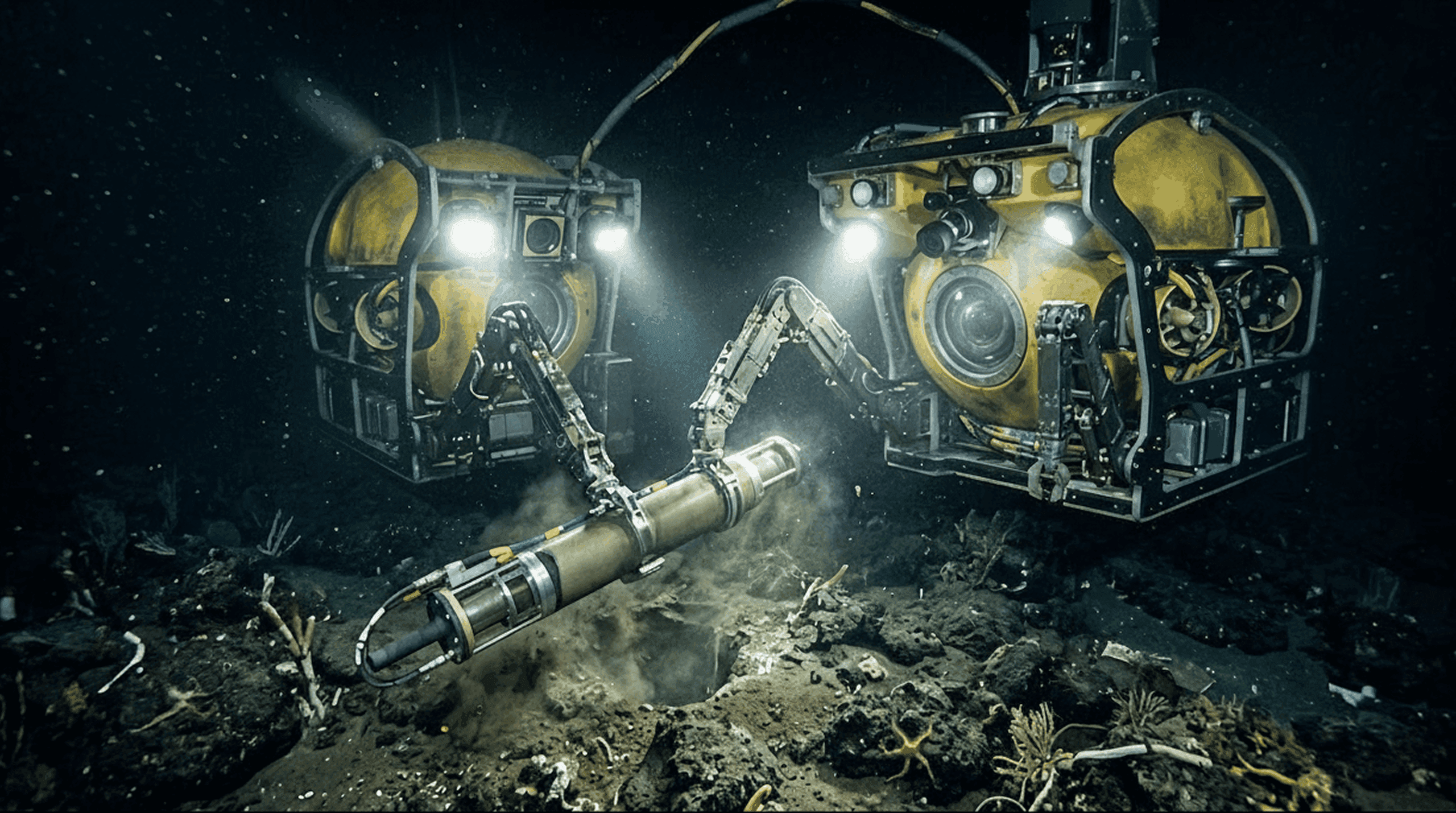
Operation

Fleet scans, samples, and maps the seafloor simultaneously. Data streams to mothership in real-time.

The Missing Map

We Have Better Maps of Mars Than Our Own Ocean Floor.

72.7% of the ocean floor has never been mapped to modern standards. Each rover in our fleet carries a LIDAR array that scans the seafloor in real-time, building centimeter-resolution 3D terrain models as it moves.

1 sub

Mothership

Mobile base station at 4km

5 rovers

Simultaneous scan

LIDAR-equipped spheres

1000s km²

Per mission

Centimeter resolution

Shared data

Bathymetric dataset

Available to researchers

The map is the foundation. Pharma teams need it to find vents. Mining companies need it to locate nodule fields. Climate scientists need it for current flow models. Everyone starts here.

Aligned with the Nippon Foundation-GEBCO Seabed 2030 initiative to map the entire ocean floor by 2030

Applications

Four Industries. One Platform.

Scientist in dark laboratory examining a glowing bioluminescent vial collected from deep-sea organisms

Pharmaceutical Discovery

13 marine-derived drugs have FDA or EMA approval, with 22+ in clinical trials. Deep-sea organisms have yielded treatments for leukemia, breast cancer, chronic pain, and lymphoma. Over 40,000 marine natural products isolated to date.

Periodic table elements cobalt, manganese, and neodymium displayed alongside a polymetallic manganese nodule

Rare Earth Minerals

The Clarion-Clipperton Zone alone holds 21.1 billion tons of polymetallic nodules valued at up to $20 trillion. Manganese, cobalt, nickel, and rare earths in quantities exceeding known terrestrial reserves.

CTD rosette oceanographic sampling instrument on a research vessel deck at night

Climate Science

Oceans absorb 26% of humanity's CO₂ emissions and >90% of excess heat. Yet ocean CO₂ measurement coverage has declined by nearly half since 2017, threatening the monitoring infrastructure.

Yellow spherical autonomous rover servicing a subsea fiber optic cable on the ocean floor

Subsea Infrastructure

Over 1.4M km of subsea cables carry 97% of intercontinental data. Current inspection costs $30,000–$75,000/day. Autonomous submarine-deployed rovers could cut this dramatically.